Grand Tours of Scotland’s Lochs episode 2: Paul travels from Loch Gairloch to Loch Maree, a grand tour that includes meeting the king and queen of Islonia, matching a medieval feat of archery, diving on a wartime wreck in Loch Ewe and finding himself short-changed at the money tree on an island in Loch Maree.
Grand Tours of Scotland’s Lochs episode 2
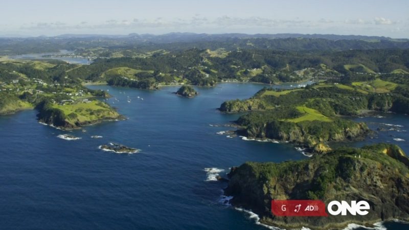
Loch Gairloch
Loch Gairloch is a sea loch on the North West coast of Highland, Scotland. In Scottish Gaelic it is an Geàrr Loch meaning ‘the short loch’. Around 6 miles (9.7 km) long by 1.5 miles (2.4 km) wide, it leads west to the Little Minch.
Loch Maree
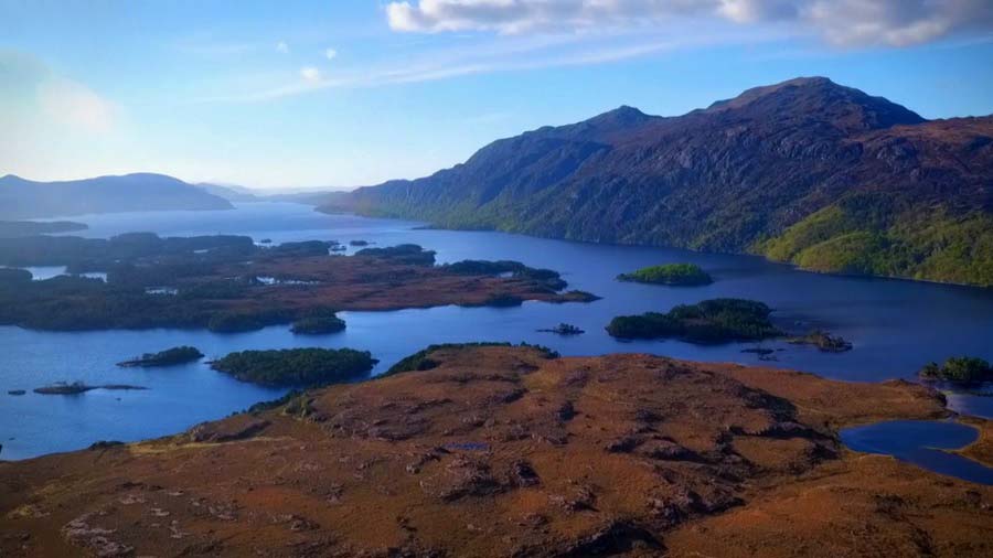
Loch Maree is a loch in Wester Ross in the Northwest Highlands of Scotland. At 21.7 km long and with a maximum width of 4 km, it is the fourth largest freshwater loch in Scotland; it is the largest north of Loch Ness. Its surface area is 28.7 km2.
Loch Maree contains five large wooded islands and over 60 smaller ones, many of which have their own lochans. The largest island, Eilean Sùbhainn, contains a loch that itself contains an island, a situation that occurs nowhere else in Great Britain. Isle Maree holds the remains of a chapel believed to be the 8th century hermitage of Saint Máel Ruba (d. 722), who founded the monastery of Applecross in 672. It is after him that Loch Maree is named; prior to the saint’s arrival in the area the loch is believed to have been named Loch Ewe, as evidenced by the name of the village of Kinlochewe which is located at the eastern end of Loch Ewe.
Loch Ewe
Loch Ewe is a sea loch in the region of Wester Ross in the Northwest Highlands of Scotland. The shores are inhabited by a traditionally Gàidhlig speaking people living in or sustained by crofting villages, the most notable of which, situated on the north-eastern shore, is the Aultbea settlement. The four-mile long River Ewe enters Loch Ewe from the following thirteen lochs of the surrounding basins.
Due to the rugged and inaccessible terrain in which it is located, Loch Ewe has always been an assembly point for maritime trade. Around 1610 the area at the head of Loch Ewe, today known as Poolewe, was urbanised around an iron furnace using charcoal produced in the surrounding woodlands for fuel. English ironmasters found it more economic to ship the ore to Poolewe for smelting than to ship the processed charcoal to England to run furnaces there.
The crofting villages which were established in the 1840s, as a result of the local parish’s estate being reformed from run-rig to fixed holdings properties, were always quite small. Bualnaliub, nine miles (fifteen kilometres) to the north of Poolewe, had eleven houses and fifty people at the 1841 census – twenty-three of whom were from the same (McIver) family. Mellon Charles, four miles (six and a half kilometres) to the west, had two hundred and sixteen people in forty-one houses – including seventeen houses headed by a McLennan. Ormiscaig, roughly halfway between them, had ten houses (four headed by McGregors) totalling forty-eight people. One hundred and forty years later, in 1981, the population was ten at Bualnaluib, twenty-four at Ormiscaig and one hundred and ten at Mellon Charles.