Making Scotland’s Landscape episode 1: Professor Iain Stewart presents a landmark five-part series in which he reveals how Scotland’s unique and beautiful landscape has been shaped over the centuries.
In this first programme, he uncovers how, over thousands of years, the actions of mankind and the climate nearly led to the downfall of Scotland’s trees and forests. It was only in the 18th century that man realised the extent of the damage to timber stocks, and measures were taken to re-populate the landscape. The impact was profound, but not everyone agreed with the results.
In a country celebrated for its unique ‘natural’ beauty, Professor Iain Stewart reveals how every square inch of Scotland’s landscape has been affected by centuries of human activity.
Making Scotland’s Landscape episode 1
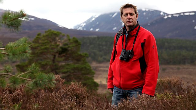
Iain Stewart
Iain Simpson Stewart is a Scottish geologist who is currently Jordan-UK El Hassan bin Talal Research Chair in Sustainability at the Royal Scientific Society in Jordan. He is a UNESCO Chair in Geoscience and Society and formerly a member of the Scientific Board of UNESCO’s International Geoscience Programme. Described as geology’s “rock star”, Stewart is best known to the public as the presenter of a number of science programmes for the BBC, notably the BAFTA nominated Earth: The Power of the Planet (2007).
He is a Fellow of the Geological Society of London, the Royal Society of Edinburgh, and President of the Royal Scottish Geographical Society. Until 2021 he was Director of the Sustainable Earth Institute at University of Plymouth and remains a of Professor of Geoscience Communication there, in addition to his role as co-Director of the Centre for Climate Change and Sustainability at Ashoka University.
Scotland’s Landscape
The mainland of Scotland comprises the northern third of the land mass of the island of Great Britain, which lies off the north-west coast of Continental Europe. The total area is 30,414 square miles (78,772 km2), comparable to the size of the Czech Republic. Scotland’s only land border is with England, and runs for 60 miles (96 km) between the basin of the River Tweed on the east coast and the Solway Firth in the west. The Atlantic Ocean borders the west coast and the North Sea is to the east. The island of Ireland lies only 13 miles (21 km) from the south-western peninsula of Kintyre; Norway is 190 miles (305 km) to the east and the Faroe Islands, 168 miles (270 km) to the north.
The territorial extent of Scotland is generally that established by the 1237 Treaty of York between Scotland and the Kingdom of England and the 1266 Treaty of Perth between Scotland and Norway. Important exceptions include the Isle of Man, which having been lost to England in the 14th century is now a crown dependency outside of the United Kingdom; the island groups Orkney and Shetland, which were acquired from Norway in 1472; and Berwick-upon-Tweed, lost to England in 1482.
The geographical centre of Scotland lies a few miles from the village of Newtonmore in Badenoch. Rising to 1,344 metres (4,409 ft) above sea level, Scotland’s highest point is the summit of Ben Nevis, in Lochaber, while Scotland’s longest river, the River Tay, flows for a distance of 118 miles (190 km).