Galapagos: Enchanted Isles – A look at how the Galapagos became one of the most important areas of biodiversity in the world. Only the hardiest pioneers could reach this otherworldly outpost – tossed here by storms and strong currents, they found an unspoilt land of endless possibilities.
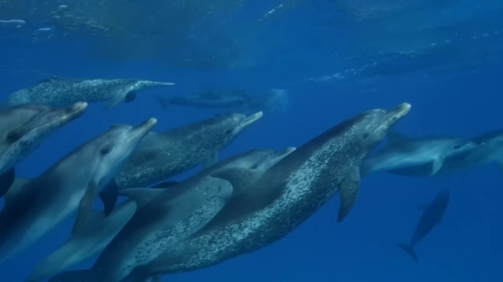
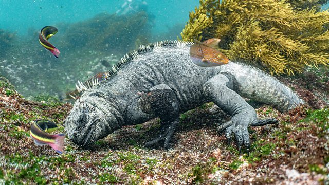
With no competition, they could rule supreme, turning this seemingly inhospitable place into their very own Eden. Now, the islands are home to almost 2,000 species found nowhere else, including 97% of its reptiles and mammals.
Travel to the far corners of the planet and discover the secrets of Earth’s few remaining untouched lands, all brimming with life. Helena Bonham Carter introduces us to some of the planet’s most stunning wildernesses around the world, and their beautiful and fascinating inhabitants. The filmmaker explores the remote areas across Earth that are untouched by human civilization and are flourishing with rich biodiversity.
Galapagos: Enchanted Isles
The Galápagos Islands, part of the Republic of Ecuador, are an archipelago of volcanic islands. They are distributed on either side of the equator in the Pacific Ocean, surrounding the centre of the Western Hemisphere. Located 906 km (563 mi) west of continental Ecuador, the islands are known for their large number of endemic species that were studied by Charles Darwin during the second voyage of HMS Beagle. His observations and collections contributed to the inception of Darwin’s theory of evolution by means of natural selection.
The Galápagos Islands and their surrounding waters form the Galápagos Province of Ecuador, the Galápagos National Park, and the Galápagos Marine Reserve. The principal language on the islands is Spanish. The islands have a population of slightly over 25,000.
The first recorded visit to the islands happened by chance in 1535, when Fray Tomás de Berlanga, the Bishop of Panamá, was surprised to find this undiscovered land on a voyage to Peru to arbitrate in a dispute between Francisco Pizarro and Diego de Almagro. Berlanga eventually returned to the Spanish Empire and described the conditions of the islands and the animals that inhabited them. The group of islands was shown and named “Ins: de los galopegos” (Islands of the tortoises) in Abraham Ortelius’s map “America Sive Novi Orbis” published in 1570. The first crude map of the islands was made in 1684 by the buccaneer Ambrose Cowley, who named the individual islands after some of his fellow pirates or after English royalty and noblemen.
These names were used in the authoritative navigation charts of the islands prepared during the Beagle survey under captain Robert FitzRoy, and in Darwin’s popular book The Voyage of the Beagle. The newly independent Republic of Ecuador took the islands from Spanish ownership in 1832, and subsequently gave them new Spanish names. The older names remained in use in English-language publications, including Herman Melville’s The Encantadas of 1854. Administratively, Galapagos constitutes one of the provinces of Ecuador, made up of three cantons that bear the names of its most populated islands, namely: San Cristóbal, Santa Cruz and Isabela.