Maps: Power, Plunder and Possession episode 1: Jerry Brotton shows how maps can be tools of power and snapshots of history. Henry VIII’s maps of the British coast helped him exert control over the world.
In a series about the extraordinary stories behind maps, Professor Jerry Brotton uncovers how maps aren’t simply about getting from A to B, but are revealing snapshots of defining moments in history and tools of political power and persuasion.
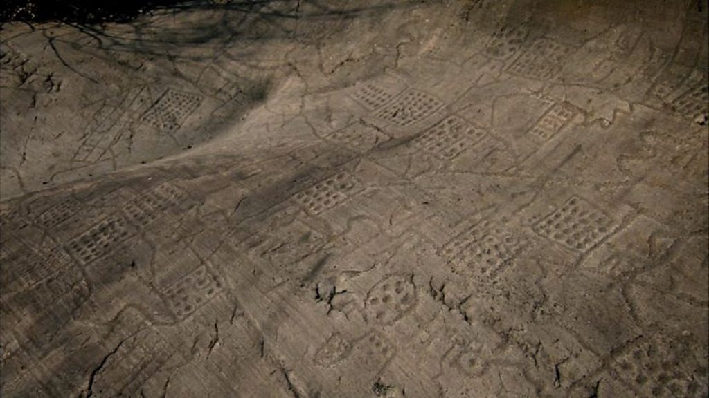
Visiting the world’s first known map, etched into the rocks of a remote alpine hillside 3,000 years ago, Brotton explores how each culture develops its own unique, often surprising way of mapping. As Henry VIII’s stunning maps of the British coastline from a bird’s-eye view show, they were also used to exert control over the world.
During the Enlightenment, the great French Cassini dynasty pioneered the western quest to map the world with greater scientific accuracy, leading also to the British Ordnance Survey. But these new scientific methods were challenged by cultures with alternative ways of mapping, such as in a Polynesian navigator’s map which has no use for north, south and east.
As scientifically accurate map-making became a powerful tool of European expansion, the British carved the state of Iraq out of the Middle East. When the British drew up Iraq’s boundaries, they had devastating consequences for the nomadic tribes of Mesopotamia.
Maps: Power, Plunder and Possession episode 1
A map is a symbolic depiction emphasizing relationships between elements of some space, such as objects, regions, or themes.
Many maps are static, fixed to paper or some other durable medium, while others are dynamic or interactive. Although most commonly used to depict geography, maps may represent any space, real or fictional, without regard to context or scale, such as in brain mapping, DNA mapping, or computer network topology mapping. The space being mapped may be two dimensional, such as the surface of the earth, three dimensional, such as the interior of the earth, or even more abstract spaces of any dimension, such as arise in modeling phenomena having many independent variables.
Although the earliest maps known are of the heavens, geographic maps of territory have a very long tradition and exist from ancient times. The word “map” comes from the medieval Latin Mappa mundi, wherein mappa meant napkin or cloth and mundi the world. Thus, “map” became a shortened term referring to a two-dimensional representation of the surface of the world.