Maps: Power, Plunder and Possession episode 2: In a series about the extraordinary stories behind maps, Professor Jerry Brotton shows how maps can reveal the fears, obsessions and prejudices of their age.
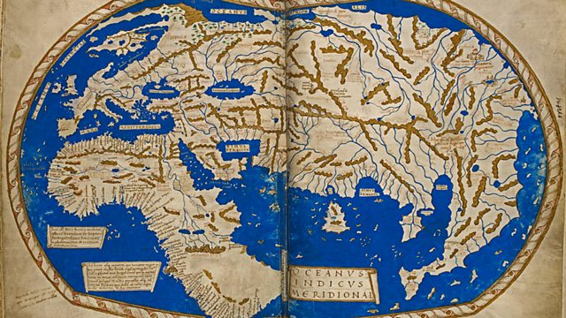
Religious passion inspires beautiful medieval maps of the world, showing the way to heaven, the pilgrims’ route to Jerusalem and monstrous children who eat their parents. But by the Victorian era society is obsessed with race, poverty and disease. Royal cartographer James Wyld’s world map awards each country a mark from one to five, depending on how ‘civilised’ he deems each nation to be. And a map made to help Jewish immigrants in the East End inadvertently fuels anti-semitism.
‘Map wars’ break out in the 1970s when left-wing journalist Arno Peters claims that the world map shown in most atlases was a lie that short-changed the developing world. In Zurich, Brotton talks to Google Earth about the cutting edge of cartography and at Worldmapper he sees how social problems such as infant mortality and HIV are strikingly portrayed on computer-generated maps that bend the world out of shape and reflect the spirit of our age.
Maps: Power, Plunder and Possession episode 2
James Wyld
James Wyld (1812–1887) was a British geographer and map-seller, best known for Wyld’s Great Globe. He was the eldest son of James Wyld the Elder (1790–1836) and Eliza (née Legg). In 1838, he married Anne, the daughter of John Hester, and had two children, one of whom, James John Cooper Wyld also became a map publisher.
On his father’s death in 1836, Wyld became the sole owner of the thriving family mapmaking business based in Charing Cross. His maps, which covered regions as diverse as London and the gold fields of California, were regarded highly, and Wyld himself had an excellent reputation as a mapmaker; he was elected as a fellow of the Royal Geographical Society in 1839, and he was appointed Geographer to Queen Victoria and Prince Albert (as had been his father before him).
He had an opportunistic approach to the business and was a prolific publisher of maps and guides (so much so that Punch claimed that if a country were discovered in the interior of the earth Wyld would produce a map of it “as soon as it is discovered, if not before”), but his projects were not always successful; although he profited from the “Railway Mania” of the later 1830s, he became entangled in a number of court cases with unsuccessful railway companies as a result, and he overreached himself by printing maps and guides of the London rail network which included stations and connections that were planned but subsequently not built.
He helped start both the Association of Surveyors and the Surveyors’ Institution to lobby against the Ordnance Survey, as he felt its activities threatened his business, but when these associations failed, he pragmatically got his company appointed as one of the six official outlets for the new OS maps. He had an account at the Royal British Bank, which collapsed in 1856, wiping out the savings of many of the depositors, but the extent of his losses is not recorded. Wyld was the chairman of the depositors committee which managed to negotiate a favourable return of 15 shillings in the pound from the shareholders.


Pingback: Maps: Power, Plunder and Possession episode 3 — HDclump